


The Opening of Kavalan
The Kavalan plain — known in the Qing records as Jiazinanlai, today as Yilan — lay on the other side of the Snow Mountains from the rest of Qing Taiwan's administrative world. The Kavalan people had farmed, fished, and traded there for centuries. The Qing court had long classified the plain as 'savage territory' and issued formal prohibitions against Han Chinese settlement, a policy designed more to avoid the administrative complications of a new frontier zone than to protect the Kavalan from encroachment.
The prohibitions were not enforced. From the late eighteenth century onward, illegal migrants crossed the mountain passes in increasing numbers, establishing farming hamlets in the plain's river deltas and occupying land in the informal but persistent way that characterized frontier expansion throughout Qing Taiwan. The court knew this was happening and chose not to intervene.
Yu Wenyi, serving as circuit intendant of Taiwan in the 1760s, was among the first officials to argue in writing that th…
Yu Wenyi, serving as circuit intendant of Taiwan in the 1760s, was among the first officials to argue in writing that this ambiguity was unsustainable. His memorial laid out the case for bringing the Kavalan plain into the formal administrative system: the alternative was a growing population of unregistered settlers outside imperial jurisdiction, a situation that would eventually produce the unrest and violence the court most wanted to avoid. The argument was sound, but the court filed and ignored it for three decades.
What finally forced the issue was Wu Sha's large-scale migration campaign beginning in 1796. Within a decade, the plain held a substantial Han Chinese population with no formal legal status, no court system, and no mechanism for resolving disputes. Yang Tingli was the official sent to assess the situation — three times over more than a decade he crossed the mountain paths, conducted surveys, recorded population figures, interviewed settlers and indigenous leaders, and submitted detailed reports to the court. His persistence was the decisive factor in the eventual decision to act. In 1812 the Kavalan Sub-Prefecture was formally inaugurated. The plain that had been off the map for a century was now part of the empire. For the Kavalan people, it was the beginning of the end of their autonomy over the land their ancestors had cultivated for generations.
What the new prefecture meant to them was that there was now a government. Before 1812 Kavalan lay outside the registered territory: Chinese who came over the divide were squatters, and if someone was robbed or killed, no office took the matter up. After 1812 there was a subprefect and there were runners, and in theory there was protection — the administration entered the Kavalan settlements as domesticated tribes and marked out reserved land around each of them, which Chinese were forbidden to purchase. The boundaries of the reserve did not hold against tenancy. The Kavalan did not grow paddy rice; they leased the land to Chinese tenants and took a rent, and the rent was set in the contract and never moved again. The tenants turned the ground into paddy and multiplied its yield several times, and the rent remained what it had been. Within thirty years most settlements held their land in name only. From the 1830s whole communities began moving south, past Su'ao and down the coast to the Qilai plain in Hualien, where they founded the Kaliawan settlements. In 1878 the Qing army broke those up in turn, in the name of opening the mountains and pacifying the tribes. Counting from Kavalan, it was the same people's second migration.
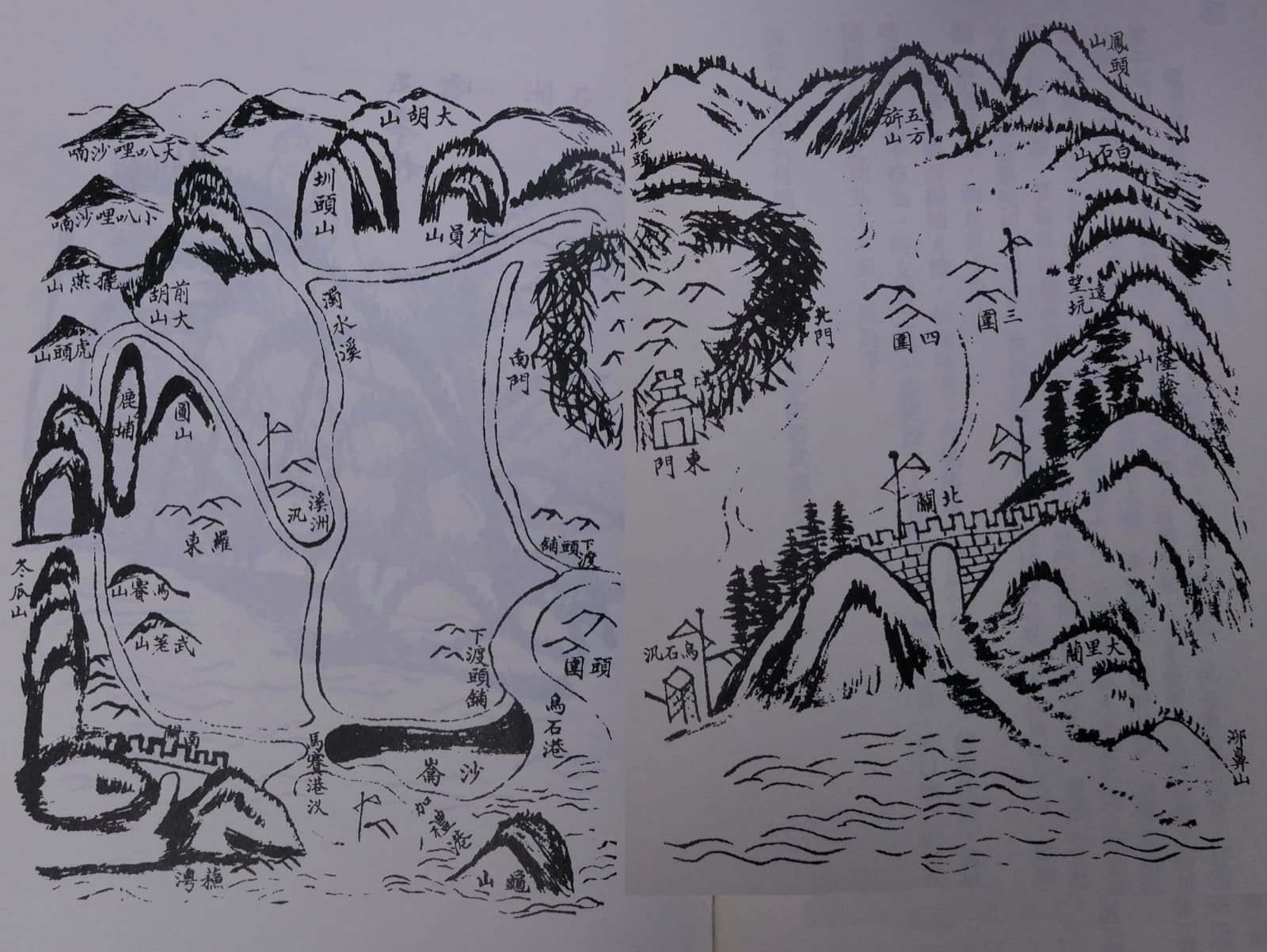
The map of Kavalan subprefecture from Ke Peiyuan's gazetteer. The subprefecture was created in 1812, sixteen years after Wu Sha went in — land the court had drawn outside its own boundary, taken inside it.
*Gazetteer of Kavalan*, by Ke Peiyuan
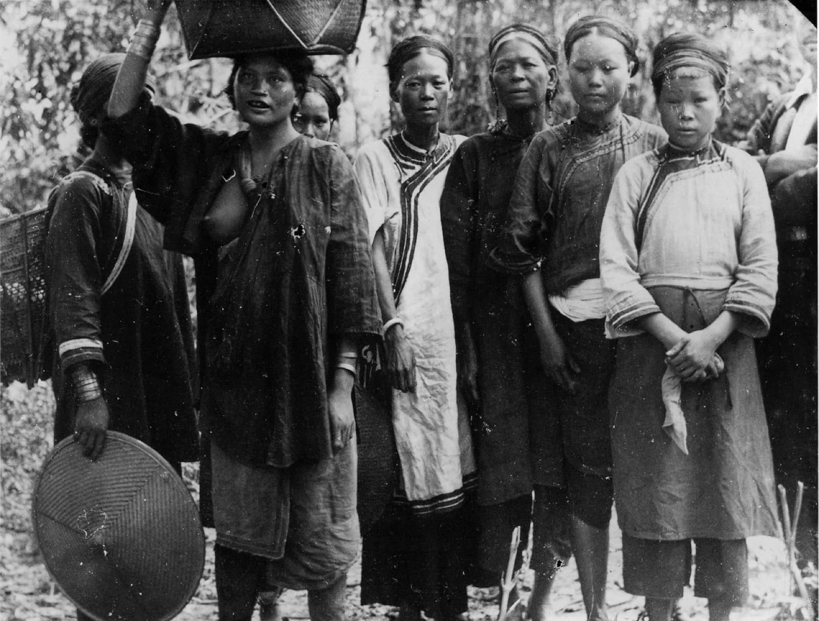
Kavalan photographed by Torii Ryūzō in 1896. After the subprefecture was founded Han settlers filled the plain, and most Kavalan moved south along the coast to Hualien and Taitung.
Photograph by Torii Ryūzō; University Museum, University of Tokyo
Isle of Time